The proposed development site is approximately 40 hectares / 100 acres of land, known as Stanworth Land.
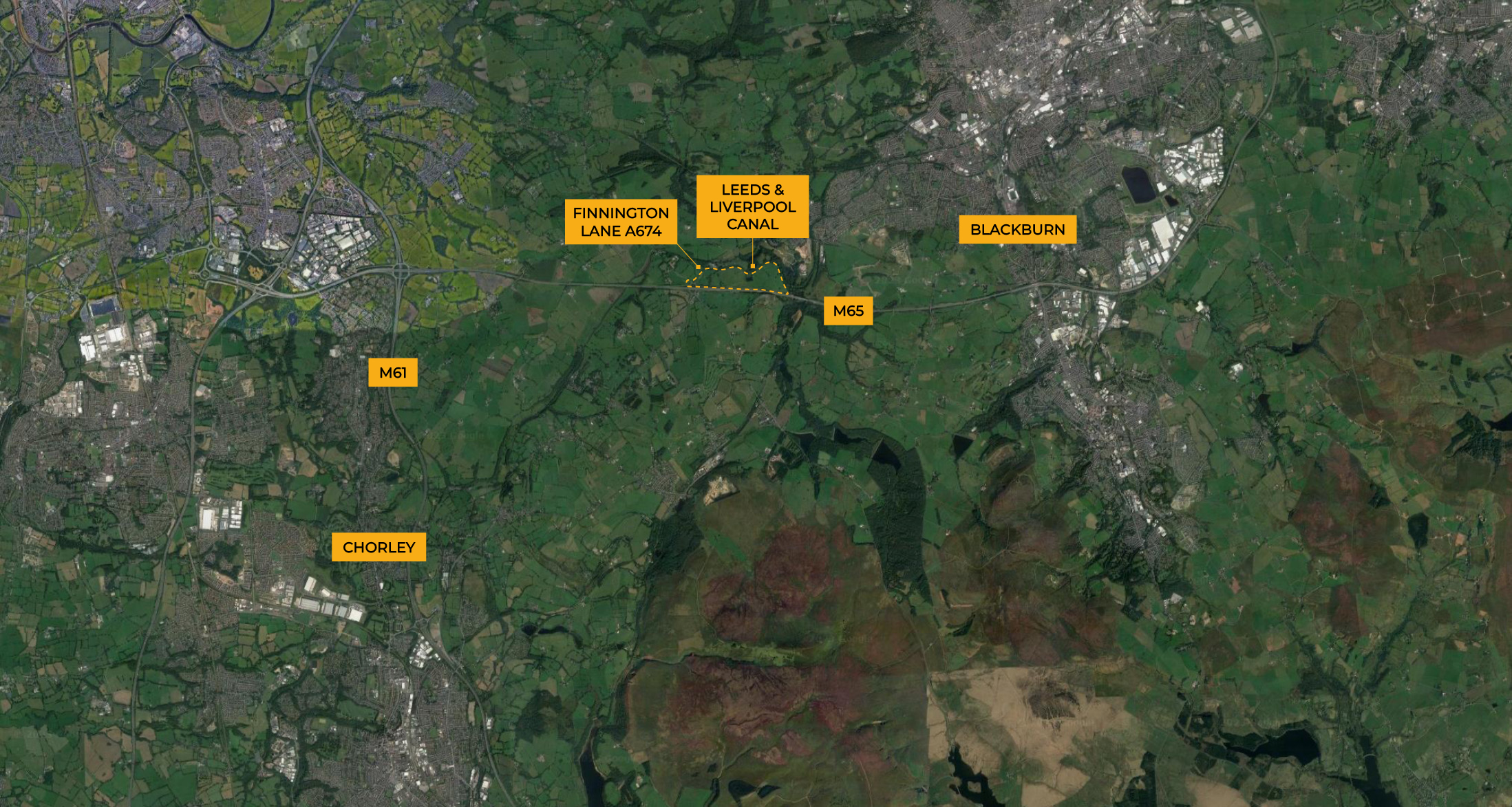
It is located to the west of Blackburn and to the northeast of Junction 3 of the M65 accessed off the A674 Finnington Lane that leads from the junction. The site is bounded by the Leeds and Liverpool Canal to the north and Stanworth Woods to the east.
The site is ideally located for a logistics park, owing to its strong travel connections onto the M65, and is favourably located near to Blackburn and Preston and the national motorway network via the M6 / M61 to the northwest region.
THE SITE
The site comprises a series of fields used for pasture with a number of individual and groups of trees and hedgerows within the site. There are three small watercourses to the western side of the site that lead via culvert under the canal to Finnington Brook to the north.
The site generally slopes from south to north from the motorway towards the canal. Access is from the west off Finnington Lane beside the layby. To the east of site is an area of semi-ancient woodland that slopes steeply down to the canal cutting. The arboricultural reporting classes the woodland as ancient semi-natural woodland.
Overhead powerlines cross the site from east to west parallel to the motorway and there are two underground gas pipelines that cross the site as well as a rising water main.
One public footpath runs near the eastern site boundary as part of a wider route from south of the motorway via an under-bridge and north across the canal toward the suburbs of Blackburn.
GREEN BELT, LANDSCAPE AND HABITATS
The land is within the Green Belt at the western edge Blackburn, though administratively within Chorley Borough.
The site has no other landscape designations.
Nearest designated habitats are the Withnell Local Nature Reserve (LNR) , 1.5 km to the south; Withnell Fold LNR 2km to southwest and the West Pennine Moors Site of Special Scientific Interest (SSSI) 2.5km to the south; all beyond the motorway.